TL;DR: Centre County's Board of Commissioners declared a disaster emergency on Thursday after overnight storms flooded homes, washed out roads and forced water rescues.
Disaster Declaration Opens Door To Outside Aid
Centre County's Board of Commissioners issued a declaration of disaster emergency on Thursday after severe overnight storms caused significant flooding and damage to property, according to StateCollege.com. The action was reported on September 3, 2026 at 8:57 p.m. by author Geoff Rushton. County leaders described the damage as significant to homes, land and public systems. The declaration is a step toward seeking resources and aid from state or federal government to assist with recovery, according to StateCollege.com. That procedural step does not by itself deliver funds, but it documents that local capacity may be exceeded. The declaration states: "The heavy rains and flooding has endangered the health, safety and welfare of a substantial number of persons residing in Centre County, and threatens to create problems greater in scope than Centre County may be able to resolve." For preparedness readers, the lesson is that a county-level declaration is the trigger for damage reporting and higher-level assistance. Residents should document losses early and use official channels. Keep copies of photos and reports in a dry, accessible place.
Overnight Deluge Hit Northeast Centre County Hardest
Torrential rain started Wednesday night and continued into Thursday, dumping from 2 inches to 5.5 inches of rainfall on parts of the area in about nine hours, according to StateCollege.com. The Howard area in the northeastern part of the county was among the hardest-hit zones. A separate morning report described 2 to 4 inches across parts of the region, with the most severe conditions in northeastern Centre County, according to StateCollege.com. Storms brought more rain later in the morning and in the evening on Thursday. A flash flood watch remained in effect until midnight Thursday. Flood watches remained in effect until Thursday night for all of Centre County as storms with heavy rainfall and strong winds were again forecast throughout the day. Saturated ground meant renewed rain could quickly worsen creek and roadway flooding. People living near creeks, streams, low-lying areas and roadways faced rapid onset risk.
Tornado Warning, Then Flash Flood Warning
Storms were particularly severe in northeastern Centre County, where a tornado warning was issued on Wednesday from 8 to 9:15 p.m. for the area of Howard, Blanchard and Orviston, according to StateCollege.com. That warning was followed by a flash flood warning into the early morning hours. Centre County 911 reported on Wednesday night that flooding was occurring in the area of Howard, Curtin Township and Liberty Township from Orviston Mountain Road to Clinton County. Water rescues were also reported in that area. The agency wrote on Facebook on Wednesday night: "Periods of heavy rain have created hazardous conditions across Centre County, particularly Howard, Curtin Twp, Liberty Twp, and additional rainfall is possible." The same message warned that flooding can develop quickly, especially near creeks, streams, low-lying areas and roadways. For households, the sequence matters for planning. A nighttime tornado warning followed by flooding limits travel options and sleep. Keep a battery-powered weather radio where it can wake you.
Water Rescues, Evacuations And Power Loss
The storm washed out roads, downed trees and led to numerous water rescues by emergency responders, according to StateCollege.com. Emergency officials in Centre County said heavy overnight rainfall impacted several rural towns, prompting some residents to be evacuated and forcing others to be rescued, according to WJAC. WJAC reported severe flooding in the areas of Howard and Orviston while county officials were still working to assess damage and impacts. Cleanup was underway in the town of Monument where residents were without power, according to a WJAC news crew. According to Centre County Emergency Management, flooding damaged homes, properties, roadways and other infrastructure. The combination of evacuations, rescues and outages shows why rural flood plans must cover shelter, communications and power. Charge phones before storms arrive and know where to go if water rises at night. Never walk into moving water.
Creeks Approached Records Near Beech Creek Station
Major flooding was occurring and major flooding was forecast on Bald Eagle Creek near Beech Creek Station affecting Clinton and Centre Counties, according to the National Weather Service via Weather Alert Watch. At 5:30 AM EDT Thursday the stage was 15.1 feet. The creek was expected to rise to a crest of 15.3 feet Thursday morning, then fall below flood stage just after midnight. Flood stage is 11.0 feet and major flooding is 15.0 feet. The bulletin said this approaches the flood of record and compares to a previous crest of 15.6 feet on 01/19/1996. At 15.0 feet, homes in the cottage area are cut off by high water and directly affected, according to the bulletin. The warning was in effect until Friday morning. The bulletin advised: "Turn around, don't drown when encountering flooded roads. Most flood deaths occur in vehicles." Additional information was available at www.weather.gov.
Marsh Creek Set A New High Mark
Marsh Creek at Blanchard reached 4.13 feet by Thursday afternoon, down from a crest of 9.86 feet at 1:30 a.m. Thursday, September 3, according to The Express in Lock Haven. The previous record at that station was 7.8 feet. Bald Eagle Creek was at 11.60 feet, down from a crest of 15.12 feet at 5 a.m. Thursday, with a station record of 16.0 feet, according to The Express. The Susquehanna at Lock Haven was at 10.30 feet, with a crest of 12.20 feet forecast Friday, September 4 at 8 p.m., below the 17-foot action stage. The Susquehanna at Renovo was at 3.44 feet, with a crest of 8.80 feet forecast Friday at 8 p.m., below the 12-foot action stage. The Susquehanna at Jersey Shore was at 9.75 feet, with a crest of 11.30 feet forecast Friday at 8 p.m. Falling gauges did not end the danger because ground was saturated. Relatively small additional rainfall could quickly produce renewed flooding.
Rainfall Totals Explain The Washouts
Rain gauges throughout the area registered heavy totals between September 2 and September 3 as of 3 p.m. Thursday, according to The Express. Howard recorded 3.98 inches. Beech Creek recorded 7.45 inches. Mill Hall recorded 5.20 inches. Lamar recorded 5.36 inches. Dunnstown recorded 4.33 inches. Avis recorded 3.71 inches. Jersey Shore recorded 4.66 inches. The Express reported that much of the rainfall came during several intense rounds over periods of only a few hours, producing rapid rises on creeks and streams. The same report said some areas received more than 7 inches of rain in less than 24 hours. That intensity explains washed-out roadbeds and debris-covered routes. For future storms, track gauge totals rather than only daily forecasts. Store fuel, food and water so you can avoid travel during peak runoff.
Road Network Fractured Across Two Counties
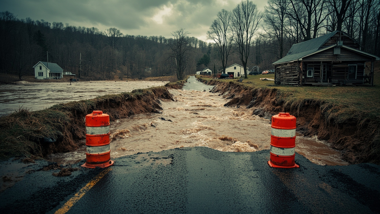
Road closures reported as of 8 a.m. Thursday by PennDOT and local emergency communications included Fox Hollow Road from Toftrees Avenue to the I-99 overpass in Patton Township, according to StateCollege.com. The list also included Marsh Creek Road between Howard Divide and Bald Eagle Valley roads. Monument/Orviston Road/Beech Creek Road was listed as closed. Hunter Run Road at Bald Eagle Valley Road was listed as closed. Repairs were underway after overnight flooding damaged or washed out several roadways, including along Marsh Creek Road in Liberty Township, according to WJAC. According to PennDOT, flooding concerns prompted the closure of multiple roadways in Centre and nearby Clinton County. Drivers were advised that roads were closed or restricted due to downed trees, utilities and flooding, according to northcentralpa.com. Do not drive around barricades or attempt to cross flooded roads.
PennDOT Listed Closures And A Serious Washout
In Centre County, Route 1002 (Marsh Creek Road) was closed between Howard Divide and Bald Eagle Valley roads, according to northcentralpa.com. In Clinton County, Route 150 in both directions was closed between Lusk Run and Mill Hall roads. Route 2019 (Laurel Run Road) was affected. Route 2020 (Lusk Run Road) near the township building was affected. Route 2022 (Sugar Run/Laurel Run Road) was affected. Route 1016/2024 (Orviston/Beech Creek Road), which crosses Centre and Clinton counties, was also affected. Rockey Road was to be closed indefinitely after a serious washout, in a photo credited to Sugar Valley Community Fire Company, according to northcentralpa.com. Other regional closures included parts of Lycoming, Northumberland, Snyder and Union counties. A section of the Bald Eagle Valley Trail was reported closed Thursday afternoon from the Castanea Fire Station (Station 3) to mile 1.5 due to severe storm damage, according to The Express. Lock Haven City Police urged residents to avoid unnecessary travel where possible. Anyone experiencing an emergency was told to contact Clinton County Communications Center at 570-748-2936 or call 911, according to The Express.
Schools Closed And Delayed As Response Continued
Bellefonte Area School District was closed on Thursday, while State College Area and Bald Eagle Area were operating on two-hour delays, according to StateCollege.com. The closures and delays followed overnight storms that flooded roads Thursday morning. They reduced school-bus traffic during active water rescues and road assessments. Families should have a backup morning plan for sudden closures. Keep children away from flooded streams and roadways and monitor weather and emergency alerts.
How To Report Damage For Recovery
Centre County Emergency Management is asking residents whose properties were affected to report their damage through an online form and to include photos showing the damage when possible, according to StateCollege.com. The agency wrote: "Your report will help emergency management officials assess the overall impact of the storm and support ongoing response, recovery, and damage assessment efforts." In response to the flooding damage, Centre County declared a disaster emergency while encouraging impacted residents to report property damage, according to WJAC. While county officials were still working to assess damage, reports pointed to severe flooding in Howard and Orviston. Photograph damage before cleanup where safe. List affected rooms, systems and belongings. Save receipts for temporary repairs and supplies.
Sources referenced
- Centre County Issues Disaster Emergency Declaration After Severe Storms Cause Flooding, Damage | StateCollege.com (https://www.statecollege.com/articles/local-news/centre-county-issues-disaster-emergency-declaration-after-severe-storms-cause-flooding-damage/)
- Severe Storms in Centre County Cause Road Flooding, School Delays and Closure | StateCollege.com (https://www.statecollege.com/articles/weather/severe-storms-in-centre-county-cause-road-flooding-school-delays-and-closure/)